
At 158 homes the scheme sits eight above the level that lets the Mayor take the decision. Harrow's adopted plan still calls the land green belt.
Public consultation on 158 homes on green belt land off Headstone Lane closed at midnight on Friday 28 August. No planning application has been submitted yet. When one is, the number of homes means Harrow councillors may not have the last word.
Barwood Land is preparing an outline application for the site between Broadfields and Pinner Park Primary School. Its consultation was run by the planning consultancy CarneySweeney (consultation page).
The threshold that matters is 150. Schedule 1 of the Town and Country Planning (Mayor of London) Order 2008 makes any development that “comprises or includes the provision of more than 150 houses, flats, or houses and flats” referable to the Mayor of London (legislation.gov.uk). At 158 units, this scheme is eight above that line. Referral lets the Mayor direct refusal, or take the application over and decide it at City Hall.
What the plans actually show
The three parameter plans published with the consultation put hard numbers on the proposal. They are dated December 2025 and were last revised in January 2026.
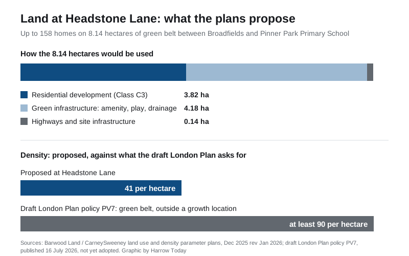
- Total site area: 8.14 hectares
- Residential development (Class C3): 3.82 hectares
- Green infrastructure, including amenity space, play and drainage: 4.18 hectares
- Highways and site infrastructure: 0.14 hectares
- Up to 158 homes at an overall average of 41 dwellings per hectare
- Density zones of up to 50, up to 40 and up to 35 dwellings per hectare
- 50 per cent affordable housing, with a high proportion of family homes
- A new vehicle access on Headstone Lane, with existing accesses retained
- Every home to have dedicated parking
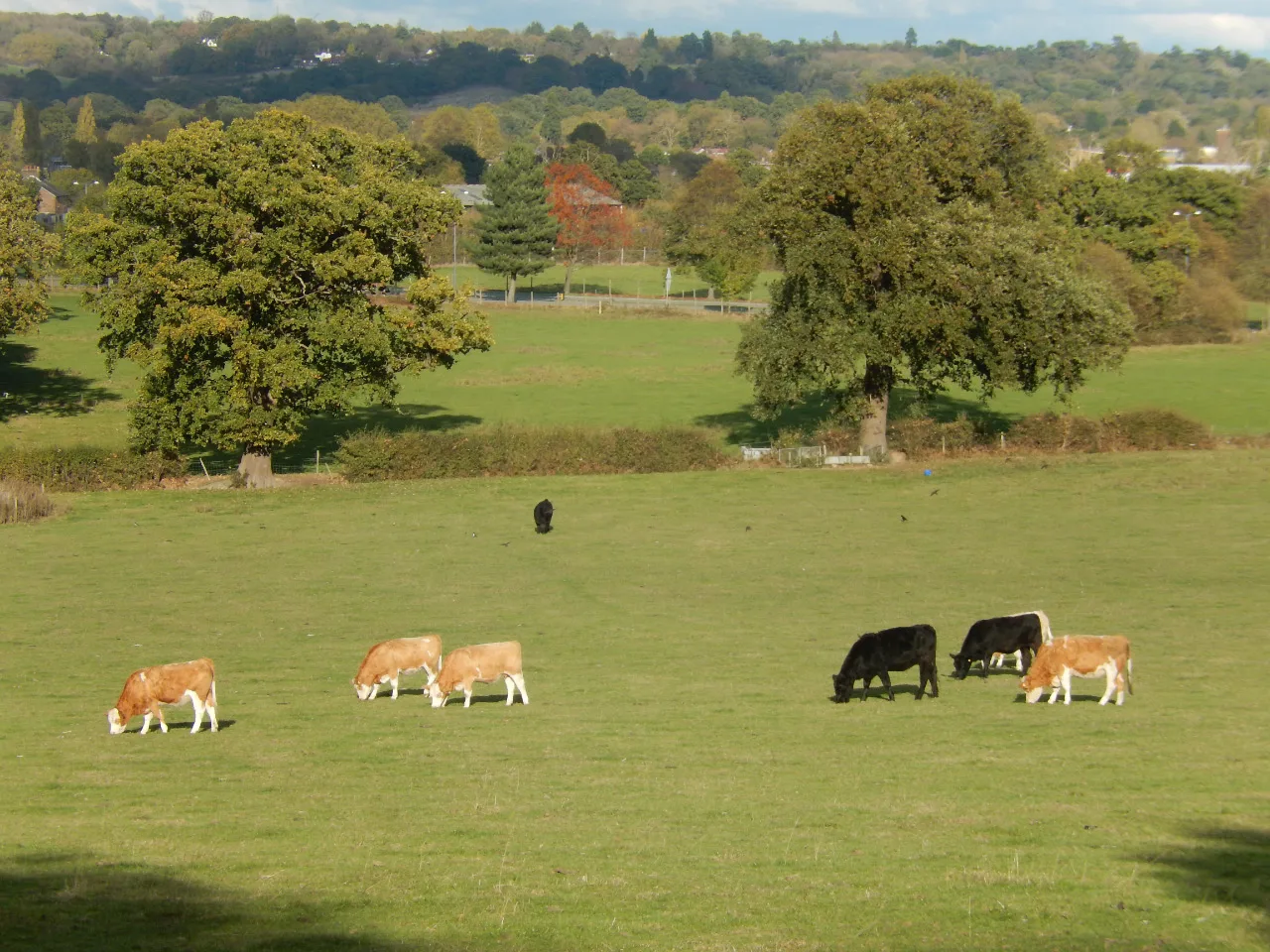
The consultation says the land was private playing fields, has been unused for 14 years and is overgrown. It says the former cricket pavilion now operates as the Blue Room events space and will stay, and that the astro pitches are currently in use as a timber yard without permission.
One detail in the consultation text is wrong. It calls Headstone Lane an Underground station. Transport for London’s own records list Headstone Lane Rail Station as London Overground only, with no Underground service. That matters, because the case for building here rests heavily on the station being 200 metres away.
The land is green belt, and the council has just said so again
Harrow Council adopted the Harrow Local Plan 2021-2041 on 24 March 2026 (Harrow Council). We covered what that plan does to the borough in our Harrow planning news page.
The developer’s own agent confirmed the designation in writing during the plan’s Regulation 19 consultation. Its representation, published by the council, states: “The site is currently designated in the Green Belt in the adopted Local Plan with no other designations.” It goes on to complain that the council discounted the site as a housing allocation “solely on the basis that it is in the Green Belt” (representation, December 2024).
That same document records two further things worth knowing. The site’s public transport accessibility level is PTAL 2, a low score, despite the station being close. And a 2013 application on part of the site, reference P/0304/13, for a 75-pitch touring caravan and camping site on 2.2 hectares, was refused.
The grey belt argument, tested against the document
Headstone’s Conservative councillors have launched a petition against the scheme. Their page says the land’s green belt status was reconfirmed by the Conservative council earlier in 2026, and that “Sadiq Khan’s London Plan has designated this land as ‘Greybelt’”, which they say weakens its protection and has given developers a chance to speculate on the site (Harrow Conservatives). The petition does not publish a signature count.
We went to the draft London Plan itself. It was published on 16 July 2026 and is out for consultation until 15 October 2026. It is a draft: it has not been examined and it has not been adopted.
Three things in it cut against the idea that the Mayor has opened this site up.
First, the plan names where green belt homes are meant to go, and this is not one of them. The Greater London Authority’s 2026 Strategic Housing Land Availability Assessment allocates Harrow’s entire green belt housing capacity, 3,150 homes, to a single cross-boundary Broad Location for Growth at Northwood. That location is set at 7,000 homes, split 3,850 to Hillingdon and 3,150 to Harrow (SHLAA, Table 13-1). Harrow’s ten-year target in the draft plan is 12,010 homes: 8,860 brownfield and 3,150 greenfield (draft London Plan, Table 3.1).
Second, the plan argues against exactly this kind of release. Grey belt is a national definition, set by government in the National Planning Policy Framework, not something the Mayor designates site by site. The draft plan says its “key aspect of divergence” from national policy is “moving away from an ad-hoc approach using grey belt”, and warns that the “disparate nature and location of much of that land would otherwise tend to result in proposals for low density development and/or development in unsustainable locations” (draft London Plan, policy PV7).
Third, the density falls well short of what the draft plan asks for. Policy PV7 part E covers major schemes in the green belt outside a Broad Location for Growth. For residential schemes it says “net densities of at least 90dph should be achieved” and that “day to day journeys should not be reliant on private vehicles”. The Headstone Lane parameter plan proposes 41 dwellings per hectare, under half that, with dedicated parking for every home.
We could not find the Headstone Lane site named as grey belt anywhere in the draft London Plan or in the evidence base published with it.
The 50 per cent affordable housing offer does line up with the draft plan. Its Table 3.2, covering schemes of 36 homes or more, sets a 50 per cent affordable housing requirement on green belt land, dropping to 35 per cent only where a scheme delivers significant transport infrastructure. Barwood’s representation says Harrow has secured an average of 23 per cent affordable housing on major residential schemes.
The neighbour that is already at risk
Immediately west of the site is Pinner Park Farm. The medieval deer park there is a scheduled monument, list entry 1019135, and Historic England has it on the Heritage at Risk Register. Its assessment records the condition as “generally satisfactory but with significant localised problems”, vulnerability as high and the trend as declining. The priority category is A, meaning no action or strategy has been identified or agreed. The recorded ownership is local authority (Historic England).
The consultation says the proposal “seeks to preserve and enhance the significance of the Pinner Deer Park, Park Farm Scheduled Monument and its setting” through a landscape and open space buffer.
What it means for you
The developer’s own consultation has closed, so that route to comment has gone. Three things are still open.
- The draft London Plan consultation closes at 5pm on 15 October 2026. This is where the borough’s 3,150 greenfield homes, the Northwood location and the PV7 density rules are decided. Respond through the Greater London Authority.
- The planning application itself. Nothing has been submitted. When an outline application is registered, Harrow will consult neighbours and publish it on its planning register, and anyone can comment then. That is the stage at which objections carry legal weight.
- The petition. Headstone’s Conservative councillors are collecting names at harrowconservatives.com/headstonelane.
One practical point to hold on to. Because the scheme is above 150 homes, a vote by Harrow’s planning committee will not be the end of it. The application goes to City Hall either way.
Have your say